
Driving Distances Across the
USA - National Scenic Byways - Rent a Car.
US Weather Forecasts - US Current Temperatures - US
Interstate Driving Conditions - US Flight Delays - US Regional Weather.

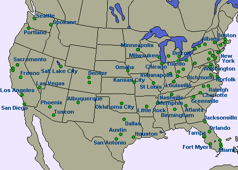
View the changing weather conditions and search for cheap hotels
along America's East-West Interstate driving routes.

Interstate 4
(132 miles)
Located wholly within Florida, Interstate 4 provides a south-west to
north-east connection across the central section of Florida; providing access to the
metropolitan areas of Tampa-St.
Petersburg, Lakeland-Winterhaven,
Orlando,
and Daytona
Beach.
Interstate 8
(348 miles)
Dropping below sea-level in the Imperial Valley, near El
Centro, Interstate 8 also traverses several mountain passes on its journey between San
Diego, California, and Casa
Grande, Arizona.
Interstate 10
(2,460 miles)
Serves the southern portion of the United States with a coast-to-coast
link from Santa
Monica and Greater Los Angeles (in the west) to Jacksonville
(in the east).
Major cities served by Interstate 10 include Los
Angeles, California; Phoenix,
Arizona; El
Paso, Texas; San
Antonio, Texas; Houston,
Texas; New
Orleans, Louisiana; and Jacksonville,
Florida.
Interstate 12
(85 miles)
The West Florida Republic Parkway is effectively a nothern bypass,
from Baton
Rouge to Slidell;
allowing travellers on southern Louisiana's section of Interstate 10 to avoid New
Orleans.
Interstate 16
(167 miles)
Interstate 16 is an intrastate Interstate highway that serves Eastern
Georgia between Macon
and Savannah.
Connecting Interstate 75 with Interstate 95, the highway provides Atlanta
traffic with access to the Atlantic Seaboard.
Interstate 20
(1,539 miles)
Starting in the vastness of western Texas, then emerging in the
south-eastern states as a major highway through several metropolitan areas, Interstate 20
provides an east-west connection through the northern tier of the Deep South states.
It begins at Interstate 10 near Kent, Texas, and passes through Midland,
Abilene,
Fort
Worth, Dallas,
Tyler,
Shreveport,
Monroe,
Jackson,
Birmingham,
Atlanta,
Augusta,
and Columbia
before culminating in Florence,
South Carolina.
Interstate 24
(316 miles)
Interstate 24 takes a northwest-southeast path through Southern
Illinois, Kentucky, and Tennessee; connecting Chattanooga,
Nashville,
Hopkinsville
and Paducah.
Interstate 26
(349 miles)
Interstate 26 extends from the Tennessee-Virginia State Line near Kingsport
south to Charleston,
South Carolina - passing through Johnson
City (Tennessee); Asheville,
Hendersonville
(North Carolina); Spartanburg,
Clinton,
Newberry,
Columbia,
Orangeburg,
Goose
Creek (South Carolina).
Interstate 30
(367 miles)
Interstate 30 joins the Dallas/Fort
Worth metropolitan area with Texarkana
and Little
Rock, Arkansas.
Interstate 40
(2,555 miles)
Interstate 40 is a major east-west freeway, spanning eight states on
its cross-country voyage from Barstow
(California) to Wilmington
(North Carolina).
Interstate 40 passes through Needles
(California); Kingman,
Flagstaff,
Winslow,
Holbrook
(Arizona); Gallup,
Grants,
Albuquerque,
Tucumcari
(New Mexico); Amarillo
(Texas); Elk
City, Clinton,
Weatherford,
El
Reno, Oklahoma
City, Henryetta
(Oklahoma); Fort
Smith, Russellville,
Morrilton,
Conway,
Little
Rock, Forrest
City, West
Memphis (Arkansas); Memphis,
Jackson,
Nashville,
Lebanon,
Cookeville,
Crossville,
Knoxville,
Newport
(Tennessee); Asheville,
Morganton,
Hickory,
Statesville,
Winston-Salem,
Greensboro,
Burlington,
Durham,
Raleigh,
Smithfield
(North Carolina).
Interstate 44
(634 miles)
A diagonal east-west route, Interstate 44 links Texas and Missouri
through the cities of Wichita
Falls, Oklahoma
City, Tulsa,
Joplin,
Springfield,
and St.
Louis.
Interstate 64
(938 miles)
Interstate 64 connects the St.
Louis metropolitan area east to the Hampton
Roads metropolitan area of southeast Virginia - connecting East
St. Louis (Illinois); Evansville
(Indiana); Louisville
(Kentucky); Charleston
(West Virginia); and Richmond
(Virginia).
Interstate 66
(76 miles)
Linking Washington
D.C. with Front
Royal, Interstate 66 serves commuter interests from the nation's capital to the
growing northern Virginia suburbs (Manassas,
Fairfax,
Vienna,
Falls
Church and Arlington).
Interstate 68
(113 miles)
Interstate 68 runs from Morgantown,
West Virginia to Hancock,
Maryland; passing through Frostburg
and Cumberland.
Interstate 70
(2,153 miles)
The sections of Interstate 70 in Missouri and Kansas were where the
nation's first Interstate was started, back in 1956.
Beginning at Cove Fort (Utah), Interstate 70 now bisects the country,
serving cities such as Denver,
Kansas
City, St.
Louis, Indianapolis,
Columbus,
Breezewood,
and Baltimore.
Westbound traffic from Cove Fort is directed onto Interstate 15 (to
Southern California) or U.S. 50 (to Northern California).
Interstate 72
(179 miles)
From Hannibal
(Missouri), Interstate 72 crosses Illinois; connecting the central Illinois towns of Quincy,
Jacksonville,
Springfield,
Decatur,
and Champaign.
Interstate 74
(428 miles)
Interstate 74 serves the Upper Midwest, Southern Great Lakes, and Ohio
River Valley area.
Travelling from the Interstate 80 interchange at Davenport
(Iowa) to Cincinnati
(Ohio) I-74 passes through Moline,
Galesburg,
Peoria,
Bloomington,
Champaign
and Danville
(Illionis); Crawfordsville,
Indianapolis,
Shelbyville
and Greensburg
(Indiana).
Interstate
76 (621 miles)
From Denver
(Colorado) to Camden
(New Jersey) this is the major east-west Interstate highway across eastern Ohio and
Pennsylvania; forming the majority of the Pennsylvania Turnpike.
I-76 travels through Fort
Morgan and Sterling
(Colorado); Akron
and Youngstown
(Ohio); Pittsburgh,
Monroeville,
Somerset,
Breezewood,
Carlisle,
Harrisburg
and Philadelphia
(Pennsylvania ).
Interstate 78
(144 miles)
Interstate 78 links Allentown,
Bethlehem
and Easton
(in Pennsylvania) with New
York City; passing through Plainfield,
Irvington,
Newark
and Jersey
City on its way.
Interstate 80
(2,900 miles)
Interstate 80 is a major transcontinental corridor connecting
California and New
York City. From the city of San
Francisco to a few miles west of the Hudson River in northern New Jersey, Interstate
80 traverses various terrain and states. Its highest point is located at Sherman Hill
Summit in Wyoming (between Laramie
and Cheyenne)
at an elevation of 8,640 feet.
Interstate 80's 2,900 mile road journey takes you to Oakland,
El
Cerrito, Pinole,
Vallejo,
Fairfield,
Vacaville,
Davis,
Sacramento,
Auburn
and Truckee
(California); Verdi,
Reno,
Sparks,
Fernley,
Lovelock,
Winnemucca,
Battle
Mountain, Carlin,
Elko
and Wendover
(Nevada); Salt
Lake City, Park
City and Echo
(Utah); Evanston,
Lyman,
Green
River, Rock
Springs, Rawlins,
Laramie,
Cheyenne
and Pine
Bluffs (Wyoming); Kimball,
Sidney,
Ogallala,
North
Platte, Lexington,
Kearney,
Grand
Island, Seward,
York,
Lincoln
and Omaha
(Nebraska); Council
Bluffs, Des
Moines, Newton,
Iowa
City and Davenport
(Iowa); Moline,
Princeton,
La
Salle, Ottawa,
Morris,
Joliet
and Chicago
(Ilinois); Hammond,
Gary,
South
Bend and Elkhart
(Indiana); Toledo,
Elyria,
Cleveland
and Youngstown
(Ohio); Sharon,
Mercer,
Clarion,
Milton,
Bloomsburg
and Stroudsburg
(Pennsylvania); Paterson
and Hackensack
(New Jersey).
Interstate 82
(143 miles)
Between Hermiston
and Ellensburg,
Interstate 82 links Interstates 84 and 90 in Oregon and Washington; passing through Kennewick,
Richland,
Grandview,
Sunnyside,
Toppenish
and Yakima.
Interstate
84 (1,002 miles)
The Western Interstate 84 is the primary route linking the
north-western cities of Salt
Lake City, Boise,
and Portland.
The Eastern Interstate 84 travels through Scranton
(Pennsylvania); Port
Jervis, Middletown,
Newburgh
and Bacon
(New York); Danbury,
Waterbury,
Bristol,
New
Britain, Hartford
and Manchester
(Connecticut); then into Massachusetts.
Interstate
86 (247 miles)
Travelling from American
Falls and Pocatello
(Idaho) to Jamestown,
Olean,
Hornell,
Bath,
Corning
and Elmira
(New York).
Interstate
88 (258 miles)
Interstate 88 connects Sterling
(Illinois) with Schenectady
(New York); through Rock
Falls, Rochelle,
DeKalb,
Aurora,
Naperville,
Downers
Grove, Elmhurst,
Villa
Park, Lombard,
Chicago,
Binghamton
and Oneonta.
Interstate 90
(3,020 miles)
The longest Interstate Highway, Interstate 90 serves major northern
cities such as Seattle,
Chicago,
Cleveland,
Buffalo,
Albany,
and Boston.
Smaller cities such as Spokane,
Butte,
Billings,
Sheridan,
Moorcroft,
Rapid
City, Sioux
Falls, Austin,
Wisconsin
Dells, Madison,
Rockford,
South
Bend, Toledo,
Erie,
Syracuse
and Springfield
also accompany Interstate 90 on its travels.
Interstate 94
(1,585 miles)
Connecting the Upper Midwest and Great Lakes regions, Interstate 94
runs from Billings
to Port
Huron; through Miles
City and Glendive
(Montana), Dickinson,
Mandan,
Bismarck,
Jamestown,
Valley
City and Fargo
(North Dakota); Fergus
Falls, Alexandria,
St.
Cloud, Minneapolis
and St.
Paul (Minnesota); Eau
Claire, Tomah,
Madison,
Waukesha,
Milwaukee,
Racine
and Kenosha
(Wisconsin); Waukegan,
Highland
Park, Skokie,
Chicago
and Calumet
City (Illinois); Hammond,
Gary,
Portage
and Michigan
City (Indiana); Benton
Harbor, Kalamazoo,
Battle
Creek, Marshall,
Jackson,
Ann
Arbor, Ypsilanti,
Dearborn
and Detroit
(Michigan).
Local Weather Forecasts -
Travel Notes Weather Channel.
Add a Business Listing - Add a Destination Guide - Add a Place to Stay.
 If you find Travel Notes useful, please take a moment to like us on
Facebook and share with your friends on social media. If you find Travel Notes useful, please take a moment to like us on
Facebook and share with your friends on social media.
|

 Travel Writer, Photographer and Internet Publisher")